 Secure Payment
 Free shipping on orders over €60 (UE)
 Financing on orders +60 €
 Hassle-free returns
Prepare Land with Maps
Download the best maps to prepare your route
Types of Maps
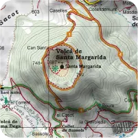
Topographic
Here you will see the terrain relief you are about to step on. The contour lines will give you an idea of the difficulty of the area. You'll find paths, shortcuts, national parks, lakes...
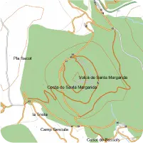
Routable
They usually contain the same type of information as topographic maps and also include urban and interurban information. Essential for using the FastTrack tool
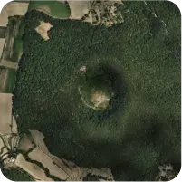
Orthophoto
Aerial photographs where you will quickly identify the elements of the landscape you are moving through: fields, lakes, refuges, roads, urban areas, buildings...
Relief
Relief maps open up the possibility to simulate the environment of your adventure with a very realistic recreation of the place in 3D so you can assess the difficulty of your route
The maps we'll need
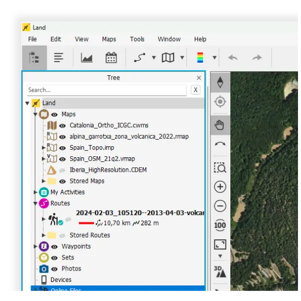
For the Garrotxa area we will use:
- Alpina Garrotxa (cost: €10): The most specialized map, it contains the most information. My favorites - Spain Topo Provinces Girona (cost: €9): Optional map. The Alpina map already covers the entire route, this one will serve as support in case of doubt - OSM Spain (cost: €4): Essential for using the FastTrack tool, which will greatly facilitate creating new sections in the track - ICC Catalonia Ortho (cost: €0): We will use it to know the terrain: if there are forests, possible refuges, or if our route will be all day in the sun - 3D Relief Spain (cost: €0): We will use it to accentuate the terrain relief on our map and to see a three-dimensional view of the place
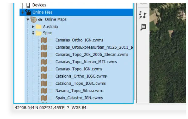
If your budget is low, I recommend using free maps, you will find them in the 'Online Maps' section in the Land data tree. In that section you will find maps from all over the world that you can use in Land and in the TwoNav App, but not in a TwoNav GPS.
- Spain Topo Online (cost: €0) - ICC Catalonia Ortho Online (cost: €0)
Mini-Tuts

How to Install Maps in Land

How to Install Maps in a TwoNav GPS or TwoNav App
Would you like to continue receiving tips like these and more information about Land 9?
Yes, I want to stay informed
 Secure Payment
 Free shipping on orders over €60 (EU)
 Hassle-free returns