Everything you need for your first safe routes in a subscription
For passionate explorers seeking safety, precision, and detailed maps. On demanding trails, trust TwoNav to find your route.
Subscribe to adventure Secure Payment
 Free shipping on orders over €60 (UE)
 Financing on orders over € 50
 Hassle-free returns Secure Payment Free shipping on orders over €60 (UE) Hassle-free returns
Embark on meticulously plotted routes with our detailed maps. Every decision is backed by accurate data, allowing you to explore with confidence and security. Experience the freedom of careful and precise planning.

Create and follow routes with precise directions, real-time alerts, and detailed visualizations. Break the boundaries of the map and live every moment knowing you have reliable information at every step.

To prevent the unexpected, prepare alternative routes and points of interest with ease. Your plan B is always just a touch away, giving you the confidence to face unexpected twists on the road with calm and determination.
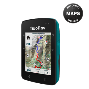
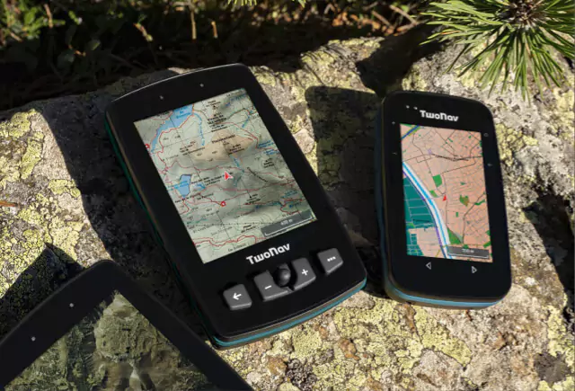
The smallest GPS with the most advanced mapping
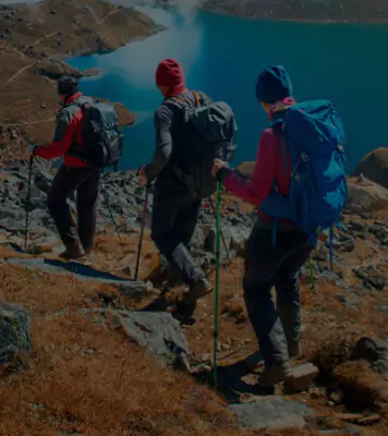
Everything you need to enjoy the mountains from start to finish
Updates throughout the year


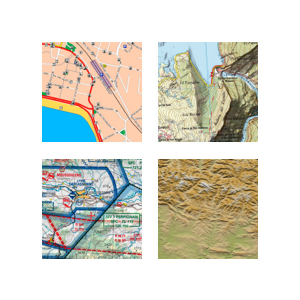
Explore nature in its purest form with our mountain maps. Exclusively designed for adventurers, they offer meticulous details and unparalleled cartographic precision. Unfold a range of possibilities with detailed information on routes and environments, giving you the confidence to discover uncharted terrain. With the excellence of our cartographic technology, every step becomes an adventure without borders.
Learn more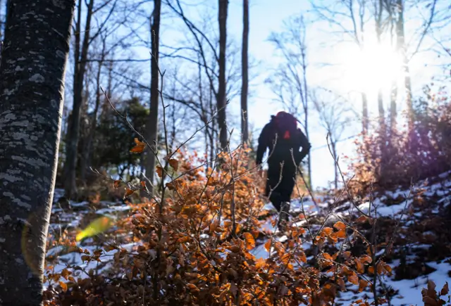
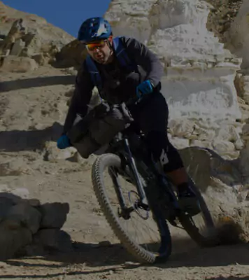
Explore nature your way with our mountain route planner. Designed for true adventurers, create personalized experiences with detailed maps and precise terrain data. Plan routes according to your preferences, from gentle hikes to challenging trails. Add a plan B within the route, always ready with a solution for any unexpected situation.
Learn more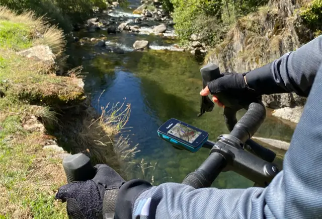
Discover new adventures with our GPS, your ultimate companion for safe mountain adventures. Equipped with unparalleled precision and detailed maps, we guide you with confidence. Overcome challenges and surprises with alternative routes and the security of being backed by the most advanced technology. Your exploration, our mission: to make you feel safe and free with every step.
Learn more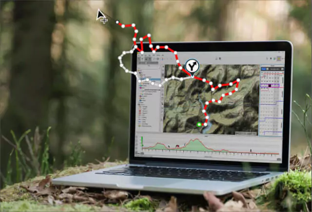
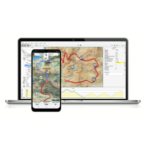
Optimize your outdoor adventures with our comprehensive solution. With Land, our intuitive Route Planner, the TwoNav Navigation App, and advanced analysis tools, you can plan, explore, and evaluate your mountain routes with precision. Store your routes and discover the freedom of worry-free exploration.
Learn moreFor passionate explorers seeking safety, precision, and detailed maps. On demanding trails, trust TwoNav to find your route.
Subscribe to adventure
Throughout 2023, we have worked to bring you significant innovations and important improvements with a single goal: to make your outings a better and safer experience. As the year comes … Segui...
Read more
Mountain fog can transform a thrilling adventure into a dangerous experience in a matter of seconds, especially during the fall and winter months. Lack of visibility can easily disorient us, … ...
Read more
On the threshold of the unknown: Discover how TwoNav empowers you At the heart of every adventure is an immutable truth: facing the unknown is the first step toward self-improvement. … Seguir L...
Read moreAsk our Support Team
Contact Secure Payment
 Free shipping on orders over €60 (EU)
 Hassle-free returns